
15
-
 [19..]
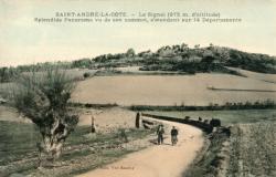
Saint-André-la-Côte. - Le Signal (975 m. d'altitude)
Inscription(s) au recto : "Splendide Panorama vu de son sommet, s'étendant sur 14 département" ; "Edit. Vve Baudoy". -
 [19..]
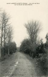
Saint-André-la-Côte (Rhône). - Un coin de Bois sur la Route de Saint-Martin
Inscription(s) au recto : "Delorme, Phot.-édit., L'Arbresle". -
 [19..]
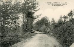
St-André-la-Côte (Rhône), alt. 900 m. - Bois Pierre Longue et route de St-Martin-en-Haut
Inscription(s) au recto : "Delorme, Phot.-édit., L'Arbresle". -
 [19..]
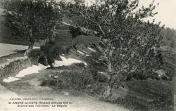
St-André-la-Côte (Rhône), altitude 900 m. - Source des Touristes. - La Bégule
Inscription(s) au recto : "Delorme, Phot.-édit., L'Arbresle". -
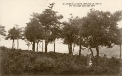 [19..]
St-André-la-Côte (Rhône), alt. 900 m. - Un Paysage dans les Pins
Inscription(s) au recto : "Delorme, Phot.-édit., L'Arbresle". -
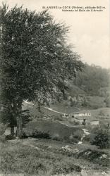 [19..]
St-André-la-Côte (Rhône), altitude 900 m. - Hameau et Bois de L'Arvein
Inscription(s) au recto : "Delorme, Phot.-édit., L'Arbresle". -
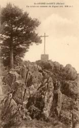 [19..]
St-André-la-Côte (Rhône). - La Croix au sommet du Signal (alt. 938 m.)
Inscription(s) au verso : "Delorme, Phot.-édit., L'Arbresle". -
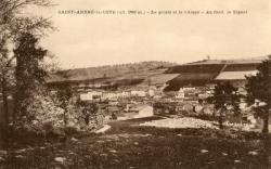 [19..]
Saint-André-la-Côte (alt. 900 m.). - La Grotte et le village.
Inscription(s) au recto : "Au fond le Signal". Au verso : "Delorme, Phot.-édit., L'Arbresle". -
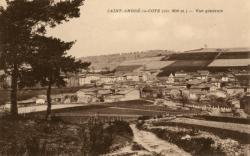 [19..]
Saint-André-la-Côte (alt. 900 m.). - Vue générale
Inscription(s) au verso : "Delorme, Phot.-édit., L'Arbresle". -
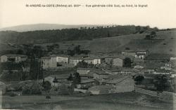 [19..]
Saint-André-la-Côte (Rhône). - Vue générale côté sud, au fond, le Signal
Inscription(s) au recto : "Delorme, Phot.-édit., L'Arbresle". -
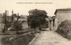 [19..]
St-André-la-Côte (Rhône). - Entrée par la route de Riverie
Inscription(s) au recto : "Delorme, Phot.-édit., L'Arbresle". -
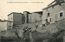 [19..]
St-André-la-Côte (Rhône), alt. 900 m. - Le Vieux Château (1636)
Inscription(s) au recto : "Delorme, Phot.-édit., L'Arbresle". -
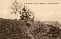 [19..]
Saint-André-la-Côte (alt. 900 m.). - La Grotte de Rampeaux
Inscription(s) au verso : "P. Delorme, phot.-édit., L'Arbresle". -
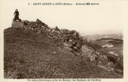 [19..]
Saint-André-la-Côte (Rhône). - Altitude 900 mètres
Inscription(s) au recto : "Un coin pittoresque près du Bourg : les Rochers de l'Ardray" ; "9". Au verso : "Edit. J. Cellard, 10, Montée du Chemin-Neuf, Lyon". -
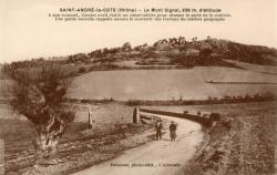 [19..]
Saint-André-la-Côte (Rhône). - Le Mont Signal, 938 m. d'altitude
Inscription(s) au recto : "A son sommet, Cassini avait établi un observatoire pour dresser la carte de la contrée. Une petite tourelle rappelle encore le souvenir des travaux du célèbre géographe" ; "Delorme, photo-édit., L'Arbresle".